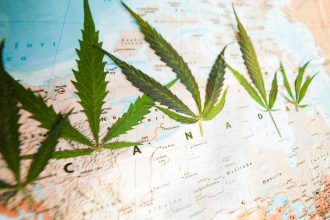
Who doesn’t love a good road trip? A long expanse of road ahead of you, a liberating sense of being in control of your own destiny and, if you take the right route, some breathtaking scenery along the way. Here are five of the most picturesque drives in Canada, where the journey itself makes the trip worthwhile.
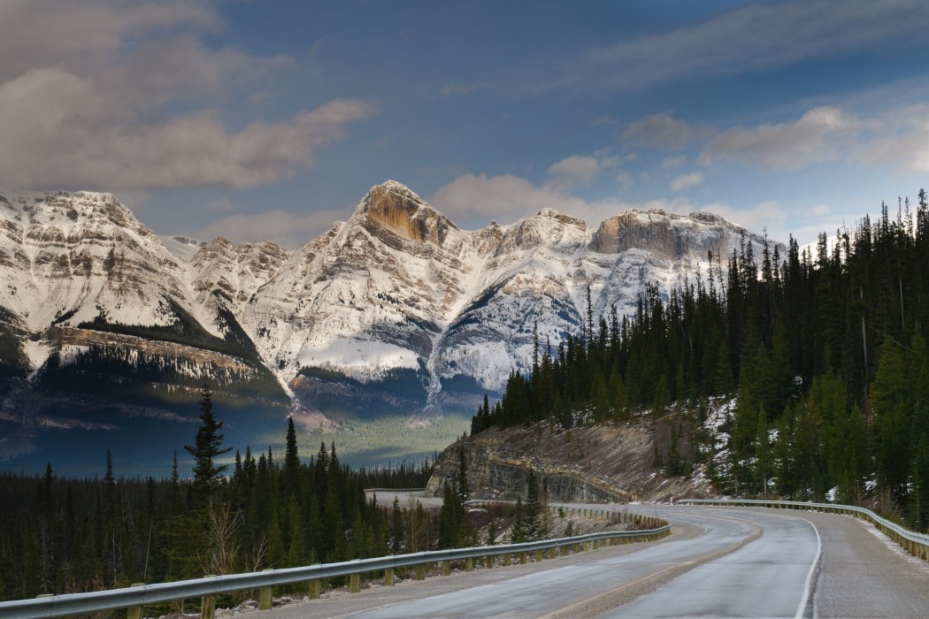
Icefields Parkway, Alberta

Photo by BGSmith/Shutterstock.com
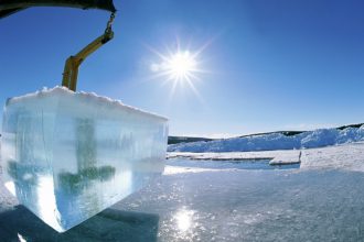
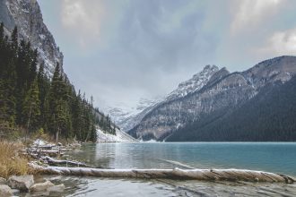
This is the drive of a lifetime; with stunning views of pristine lakes, the mighty Canadian Rockies, two gorgeous national parks, and of course the ultimate payoff—the eponymous Icefields—there is something to see at every turn. Also known as Highway 93, this 232-kilometre road runs from Lake Louise, through Banff National Park and Jasper National Park (wildlife galore!) up to Jasper. Along the way, be sure to stop off at the Columbia Icefields, which straddles the two parks and is visible from the highway. Pay a visit to the receding Athabasca Glacier before it disappears, and then take in the majesty of the Athabasca Falls nearby, where you can go white water rafting at its base.
Cabot Trail, Nova Scotia

Image via Eddy Galeotti/Shutterstock.com
Considered one of the best road trips in the world by Lonely Planet, this 300-kilometre loop named after explorer John Cabot winds around the northern end of Cape Breton Island. The circuit passes through Cape Breton Highlands National Park, charming Acadian fishing villages and a spectacular coastline. Go hiking in the highlands, fly fishing for Atlantic salmon on the Margaree River, and sailing on the lovely Bras d’Or Lake. Stop off in each of the eight vibrant communities along the trail and soak up each one’s distinctive history and culture. Your camera is bound to have countless postcard-worthy images when you’re done.
Pro tip: Be sure to use snow tires in the winter or whenever there’s ice or snow on the road, and check for road closures
Sea to Sky Highway, British Columbia

Image via Paul McKinnon/Shutterstock.com
This section of Highway 99, which connects Vancouver to just beyond Whistler, offers dramatic views of the Pacific Ocean, mountains, fjords, lakes, and waterfalls—all in the span of a two-hour drive. However, you’ll want to take your time exploring the sights along this route that begins at sea level and weaves its way through coastal rainforests and mining and mill towns until you’re suddenly 2,200 feet above sea level. Between Shannon Falls and Brandywine Falls (both short and easy hikes), stop off in Squamish for some thrilling mountain biking, with over 600 trails to choose from. Finally, check out the Whistler Train Wreck, a hike that goes along the Cheakamus River, leading to seven derailed train cars strewn amongst the forest and covered in colourful graffiti.
Pro tip: Most tourists travel the trail in a clockwise direction so that they’re in the “inside” lane as they drive along the harrowing curves of the coasts. If you (and your passengers) don’t mind cruising beside steep drops, going counter-clockwise could offer even more awe-inspiring views, and better still, less traffic.
Viking Trail, Newfoundland and Labrador

Image via Natalie Lucier, via Flickr (Creative Commons)
Escape the crowds along this beautiful 489-kilometre drive, stretching from Newfoundland’s magnificent, windswept west coast to the south of Labrador. Begin your journey at Deer Lake and make your way to Gros Morne National Park, a UNESCO World Heritage Site (although it is currently in danger of losing its status due to nearby fracking) where you can enjoy both sandy beaches and the jaw-dropping sight of freshwater fjords formed by glacial erosion. Then make your way up to L’Anse aux Meadows, a National Historic Site, and contemplate the fact that this is where the Vikings first landed more than 1,000 years ago. To complete the Labrador portion of the trail, take a ferry ride via the Labrador Ferry Service (cars are permitted) across the Strait of Belle Isle—and don’t forget to keep on the lookout for breaching whales.
Pro tip: Yes, this is an amazing drive, but it’s also been dubbed the “sea-and-die” highway due to numerous accidents that have occurred here. Improvements have been made over the years, but it’s always safer to resist the urge to exceed the posted speed limits on this road.
Dempster Highway, Yukon and Northwest Territories

Image via oksana.perkins/Shutterstock.com
If you’re craving adventure, then Canada’s most northerly highway should satisfy your desire for a challenging drive. The Dempster is a two-lane, unpaved road, extending a total of 730 kilometres from Dawson City in the Yukon to Inuvik in the Northwest Territories. Those up for this gravel-filled ride will be rewarded with some of the most incredible—and remote—views of rugged mountains and scenic wilderness in North America. Begin by immersing yourself in the history of the Klondike Gold Rush and then make your way to Tombstone Territorial Park to take in the rolling tundra and possibly even the annual birding festival in June, when the migrating birds return. Refuel and set up camp at Eagle Plains, the halfway point of the journey. Next, you’ll get to drive across the Arctic Circle (how cool is that?!) and cross the majestic Richardson Mountains, as well as the Peel and Mackenzie Rivers using a mix of seasonal ferry services and ice bridges. Squeeze in some time to spot a caribou or moose, or go fishing on the Mackenzie Delta. To conclude your trip, learn about the Inuvialuit and Gwich’in peoples at your final destination, the Land of the Midnight Sun.
Pro tip: When hanging out with the locals, you may be asked to become an official Newfoundlander through the process of being “screeched-in”; in case you’re wondering, this ceremony involves downing Screech rum and kissing a codfish on the lips.
Pro tip: Travel between June and September, when the weather is warm and and the days are long.
Runners up:
Algonquin Park Corridor, Ontario
This part of Highway 60 runs through the southern area of iconic Algonquin Park, home to an abundance of forests, lakes, rivers, wildlife and beaches. Moose sightings are frequent along this highway, so keep your eyes peeled.
St. Lawrence Route, Quebec
Covering more than 50 kilometres on Highway 362, the St. Lawrence Route (Route du Fleuve) links Baie-Saint-Paul to La Malbaie in southern Quebec’s Charlevoix region. Pass through quaint towns and villages set along the St. Lawrence River with mountains as the backdrop.
Fundy Coastal Drive, New Brunswick
The Bay of Fundy has some of the highest tides in the world, so you’re assured some exciting views driving along its coast between St. Stephen and Sackville. Feast your eyes on the fascinating rock formations and eons-old fossils found in the cliffs.